
5 Fall Rides Around DC I’d Do Right Now
Loudoun Gravel – Loudoun County, VA (Gravel)
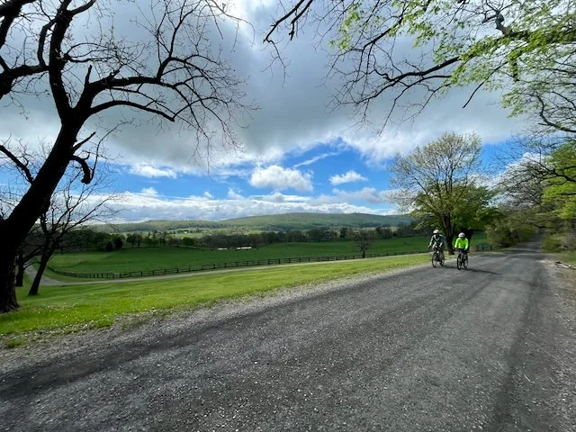
Rolling pasture, black fences, and miles of quiet gravel in Loudoun County. Shown here in early spring.
When I published the first and second editions of Mountain Biking the Washington DC/Baltimore Area in the early 1990s, opportunities to ride natural-surface trails in the region were limited. So we included several rides built around Loudoun County's extensive gravel road network, an alternative way for mountain bikers to get off pavement.
At the time, "gravel grinding" wasn't yet a defined discipline, but these quiet, out-of-the-way roads gave riders exactly what they were looking for. Remarkably, little has changed since. The network remains largely intact, tracing routes first established during the area's agricultural development in the 1700s.
Today, with gravel riding more popular than ever, Loudoun County stands out as one of the premier gravel destinations in the Mid-Atlantic, with historic scenery, rolling terrain, and nearly endless route options.
You can ride these roads year-round, but autumn is one of my favorite times to visit. When trails are wet or otherwise inaccessible, the gravel stays open, and it's a great way to take in the foliage.
Expected Fall Peak: October 18–28
Montgomery County (MoCo) – Seneca Creek Valley, MD (MTB)
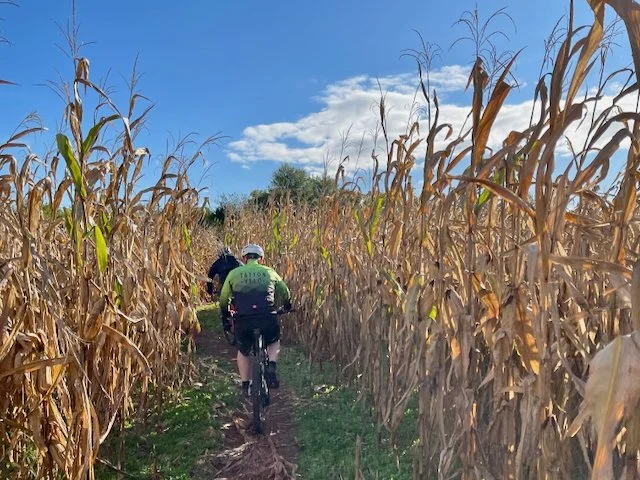
MoCo South cuts straight through working cornfields, and by fall the stalks tower over the trail.
The MoCo loops I originally presented in the book linked multiple trail systems across Montgomery County. They combine portions of Schaffer Farms, the Seneca Ridge Trail, Seneca Bluffs, the Muddy Branch Trail, and a stretch of the C&O Canal Towpath into one 40-mile ride.
My pick is the MoCo South route. It represents the culmination of trail advocacy that began in the mid-1990s, when members of the Mid-Atlantic Off-Road Enthusiasts (MORE) started building trails at Schaffer Farms with the long-term goal of connecting parks along the Seneca Creek stream valley. Today, much of the ride follows classic Montgomery County singletrack, stitched together into a true county-wide adventure.
If you have the legs and the time, this is one of the most satisfying long rides in the region, and fall is one of the best times to do it. The falling leaves and the views of the Potomac from the C&O Canal Towpath make a visual feast to go along with some of the region’s best trails.
I’ve also documented several other routes in the Seneca Creek Valley, including an equally gratifying northern loop. If you’d rather skip the epic, I highly recommend Ten Mile Creek. This fantastic ribbon of trail offers amazing views of Little Seneca Lake that are even more spectacular at peak color.
A great way to enjoy these trails is to register for MORE’s annual Epic ride - The MoCo Epic, taking place on or around Indigenous Peoples' Day (Columbus Day)
Expected Fall Peak: October 27–November 2
Sugarloaf Scenic Gravel Loop – Montgomery & Frederick County, MD (Road/Gravel)
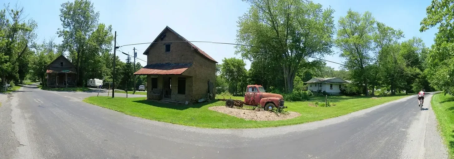
Back roads around Sugarloaf in summer, where old buildings and a rusty truck mark the way. Add fall color and it's even better.
This is another holdover from the early editions of the book, included because trail destinations were so limited back then. Like Loudoun’s gravel roads, the roads circling Sugarloaf Mountain have barely changed. The route takes you along iconic Mount Ephraim Road, a glorious stretch of gravel that Montgomery County has officially designated a Rustic Road for its landscape, historic character, and views.
The loop of dirt, gravel, and paved roads around the mountain shows off all the beauty and serenity of the Maryland countryside.
Expected Fall Peak: October 22–28
Magic Moss/Dowells – Harrisonburg, VA (MTB)
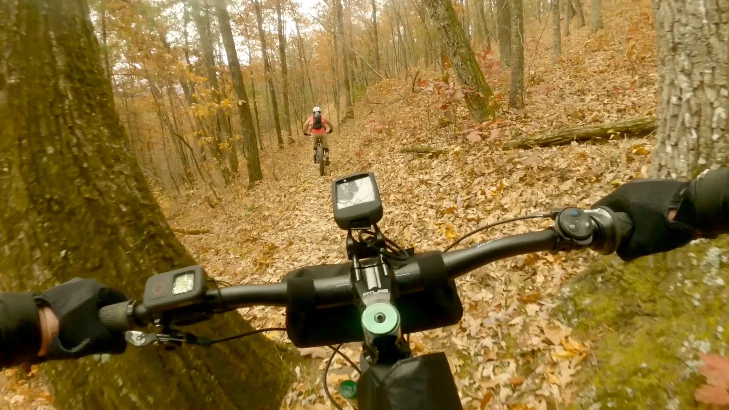
Dowells after peak. The leaves are already down, which makes the trail faster to read but harder to see what's underneath.
This is quite possibly the best ride among the many classic routes around Harrisonburg and the Stokesville Campground, a bold claim given the wealth of exceptional riding nearby. Every foot of climbing up Braley Pond Road and Magic Moss is worth the effort, and you’ll likely be planning your return before you’ve loaded the bike. The gradual gravel climb and the ascent of Magic Moss give you plenty of time to enjoy the fall color. Savor it then, because once the descent begins on Dowells, your focus will be entirely on the narrow trail, though you’ll still catch plenty of views.
To extend the day, you can easily combine this route with the Lookout Loop for more mileage and elevation. It can also be reversed, since Magic Moss makes a fantastic downhill, but ridden clockwise, climbing Magic and descending Dowells, the views, flow, and payoff are hard to beat.
Expected Fall Peak: October 12–18
The Southern Traverse - Augusta County, VA (MTB)
The Southern Traverse is one of IMBA’s designated Epic rides and can be done several ways: as a loop, a point-to-point shuttle, or an out-and-back. I strongly recommend the point-to-point, starting at the Confederate Breastworks on the Highland Turnpike (Route 250) and finishing at the Route 627 trailhead.
If you do an out-and-back, park at the Route 627 trailhead, head north toward Jerkemtight Junction, and turn around at roughly the 15-mile mark. I wouldn’t go beyond that.
The Southern Traverse lies deep in what Harrisonburg locals call the “backcountry,” and it demands total commitment. Once you reach the ridge, there are no easy exits and no reliable cell service. Even experienced riders should avoid riding it solo.
Timing matters. Early to mid-fall is ideal, when the vegetation has started to die back but leaf cover isn’t yet excessive. The trail is notoriously narrow in places, with several viewpoints that let you see the foliage before it blankets the ground. Because it’s so remote, maintenance is difficult, so expect overgrown sections, downed trees, and frequent natural obstacles.
Expected Fall Peak: October 13–19
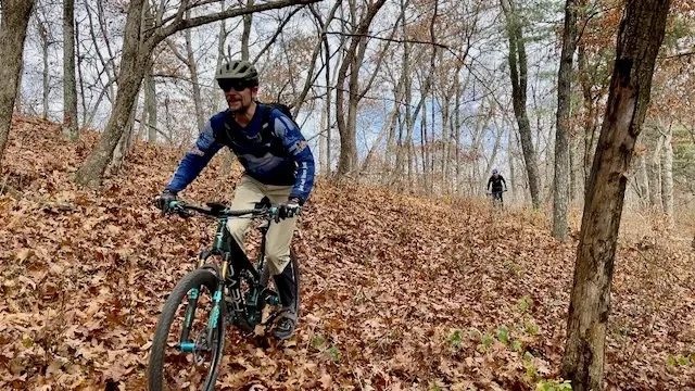
The Southern Traverse in late fall. This is what too late looks like: leaves cover the trail, and the views through the trees are wide open.
Bonus - Skyline Drive - Shenandoah Valley, VA (Road)
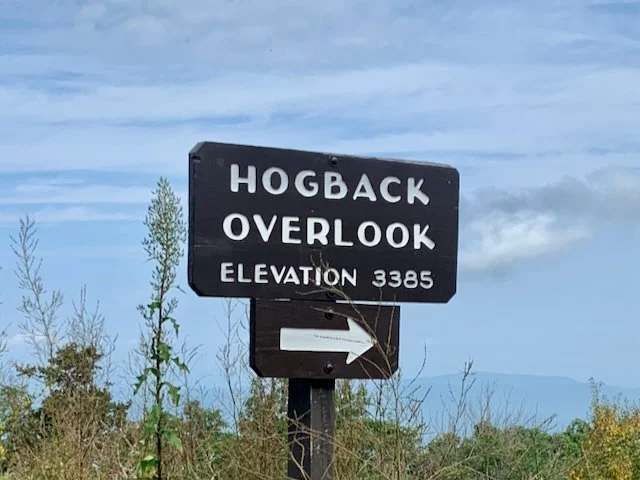
Hogback Overlook sits at 3,385 feet, which is why the high ridgeline turns first. Shown here in summer.
There’s not much I can say about Skyline Drive that hasn’t already been written. The road runs 105 miles along the crest of the Blue Ridge, overlooking the Shenandoah Valley. It begins in Front Royal and ends in Afton, VA, where its southern terminus marks the start of the Blue Ridge Parkway, another Virginia road worth a visit.
Skyline Drive lies within Shenandoah National Park, so you’ll need to pay an entrance fee to access it (the last time I rode a portion, it was $15). The fee also covers the rest of the park for seven days.
Most riders tackle only a portion of the road, or ride its entire length over two or more days. Autumn is an extremely popular time on Skyline, thanks to the views and the chance to see the Shenandoah Valley’s changing foliage. Be prepared for heavier vehicle and cycling traffic.
The route I include here is a shuttle ride covering roughly 33 miles of Skyline Drive before exiting at Thornton Gap and descending Route 211 to Sperryville. Use caution on 211. There’s vehicle traffic, and the descent can be extremely fast.
Expected Fall Peak: Depends heavily on elevation. High ridgeline: October 15–21. The National Park Service maintains a Fall Color Report on its website.