


Ride Overview
The Mount Vernon Trail (MVT) is one of the most popular bike paths in the Washington-area cycling network. Stretching from its northern terminus near Roosevelt Bridge and Key Bridge — where it connects directly to the Capital Crescent Trail — down to George Washington’s Mount Vernon Estate, the MVT provides uninterrupted waterside riding with panoramic views of the Potomac River and the Nation’s Capital.
This shared-use path also functions as a major cycling thoroughfare in the region, linking to:
The Custis Trail and onward to the W&OD Trail via the Route 66 Bike Path — providing a continuous east-west connection across Northern Virginia.
The Anacostia Riverwalk Trail and National Mall route when combined with DC cycleways.
Extensive on-street bike lanes and shared-use paths throughout Alexandria, Arlington, and the District.
Additionally, ongoing transportation planning efforts along U.S. Route 1 (Richmond Highway) — particularly through the **Crystal City and Potomac Yard area — are studying multimodal improvements that would include expanded bicycle facilities and safer bike/pedestrian accommodations to reinforce Route 1 as a stronger regional connector for people biking and walking.
The MVT and its connections are featured in Best Easy Bike Rides Washington, DC and portions are used in Best Bike Rides DC.
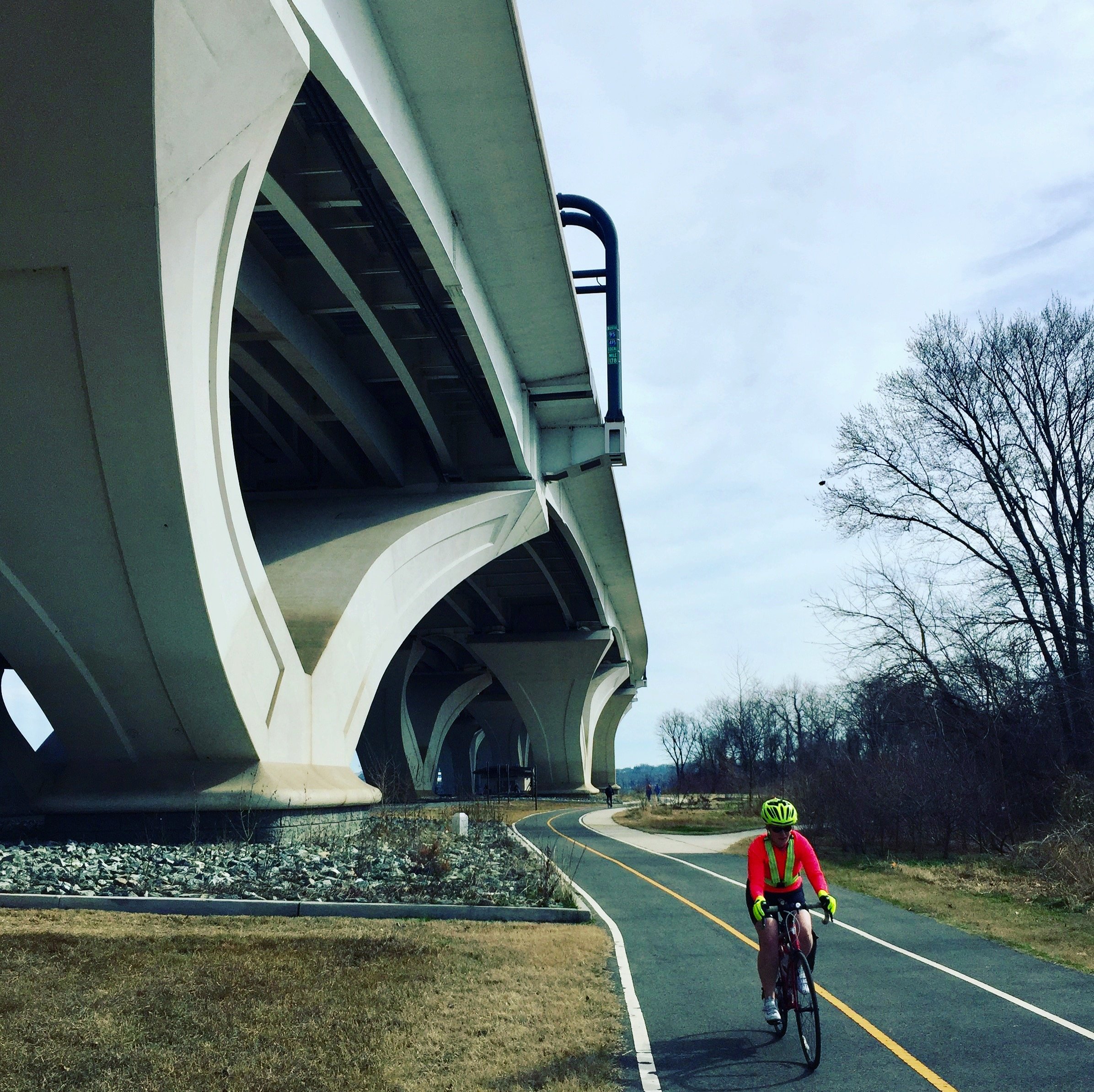
Riding along the Mount Vernon Trail near the Woodrow Wilson Bridge in Alexandria.
Ride Details at a Glance
Location: Alexandria, VA
Length: Varies (up to ~22 miles between DC and Mount Vernon)
Ride Time: depends on distances chosen
Ride Type: PATH
Difficulty: Level 1/Easy
The MVT’s mostly flat grade makes it accessible for cyclists of all skill levels, including families and leisure riders. Traffic volume can be heavy on weekends and holidays, particularly near Old Town Alexandria and along the waterfront.
Ride Notes: The Mount Vernon Trail is an easy, scenic ride, but distance and crowding can influence how challenging it feels. On spring and fall mornings, expect heavy mixed use from runners, walkers, scooters, and commuters — plus children and groups.
Extension & Connectivity:
The MVT excels as a connector in the regional cycling network. Riders coming from the National Mall or Capitol Riverfront can cross the Potomac via the Memorial, Roosevelt, or Key Bridges and link directly to the trail. From Key Bridge, the Capital Crescent Trail leads northwest into Bethesda and Silver Spring, where it ties into the Custis Trail and ultimately the W&OD Trail, creating enormous possibilities for long, looped tours across three jurisdictions.
U.S. Route 1 — which runs near the southern portions of the trail toward Mount Vernon — is also the focus of multimodal planning studies in Arlington and Alexandria that aim to improve bicycle accommodation and safety through dedicated lanes and redesigned streetscapes.
Etiquette & Safety:
Stay alert for heavy mixed use, especially near parks, waterfronts, and on weekends. When riding with children, always anticipate unpredictable pedestrian behavior and busy intersections.
Route Maps
The interactive route map below highlights the Mount Vernon Trail and the Fort Hunt loop. These can be ridden independently or combined as part of extended rides that link to the National Mall, Capital Crescent Trail, the Route 66/W&OD corridor, and other nearby paths.
These routes are documented in Best Easy Bike Rides Washington, DC, which includes additional regional context, access notes, and nearby riding options.